Delivery of timely situation analysis and decision-making information, during crisis situations including accidents and natural disasters
Tokyo, October 23, 2020 – Axelspace Corporation announces the launch of business continuity plan (BCP) support service to conduct timely situational analysis in response to accidents and natural disasters, utilizing satellite imagery data.
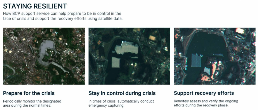
In preparation for the occurrence of incidents, including unexpected events and accidents, BCP support service will periodically monitor the designated areas by capturing satellite imagery data. It allows us to take immediate control of the crisis situation, verify the situation of target assets and the surrounding environment in a confidential manner, by conducting emergency capturing based on predetermined terms. In addition, monitoring of the current situation and verification of the surrounding environment during the recovery phase is made possible, without going to the actual location, because of periodic monitoring prior to the occurrence of the incident.
In many cases, situational analysis is conducted in an unplanned approach as the crisis unfolds, leading to difficulty in conducting verification, especially in areas restricted to enter. On the other hand, the conventional satellite imagery data takes time to arrange for the capture and has the issue of high cost for emergency capturing orders. With this BCP support service, the plan starts as low as US$500/month to capture every 3 months during the normal times and in times of crisis, will automatically capture, deliver the data and in addition, can provide data analysis service based on the client’s needs. Compared to putting a new order request at the time of incident occurrence, the BCP support service plan has a huge advantage on ease of ordering, handling speed and cost, although there will be a separate emergency handling service cost. Please reach out for details, as the emergency handling cost will be different, based on the kind of service required at the time of crisis and the latency requirements upon the occurrence of the incidents.

Figure 1: Example of the situational analysis of before and after of the damage using satellite imagery data. Floating solar power station at Yamakura dam suffered damage during the typhoon in 2019. It is possible to monitor the damage and the progress towards recovery.
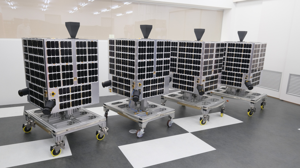
In delivering the BCP support service, Axelspace will mainly be using AxelGlobe, the company’s proprietary rapid Earth observation monitoring platform, currently in development. The first GRUS, the satellite used for AxelGlobe, was launched in December 2018 and in service already. 4 additional satellites will be launched soon, making it a 5-satellite system, allowing to monitor anywhere in the world every 3 days.

Figure 2: Four satellites (GRUS-1B, 1C, 1D, 1E) in final preparation stage for the shipment